Showing posts with label Ordnance Survey. Show all posts

Sunday, 11 February 2018

Snowdon - at last.

Oh no! The alarm hadn't gone off - I'd overslept!

Except I hadn't. I'd just dreamt that I had. This recurring (and very irritating) dream plagues my sleep whenever I have something exciting or important to look forward to the next day. And I certainly had something to look forward to. Even the thought of a 3:30am wake up and a long drive were not enough to dampen my spirits.

I dragged myself out of bed after what felt like a woefully inadequate sleep; that dream has a lot to answer for! My kit was all packed and stacked ready to go. After well over a decade of procrastination I was finally heading to Snowdon.

Having double-checked and loaded my kit, I left home and headed west for the Welsh border. On my drive I listened to the audio book of that classic tale of British wilderness (albeit Scottish rather than Welsh wilderness) 'The 39 Steps' by John Buchan. The sky was bright with a nearly full moon, although I knew that clouds were forecast to be my fate as my journey progressed.

Sure enough shortly after I crossed into the land of the Red Dragon the clouds blocked the moon as completely as if I had driven into a cave, limiting my view of the wider world to the reach of my headlights for the remainder of the trip. I made good time across Wales - at that time of morning traffic isn't exactly heavy - and arrived at Pen-y-Pass car park and the proper start of my days adventure at about 6:30am.

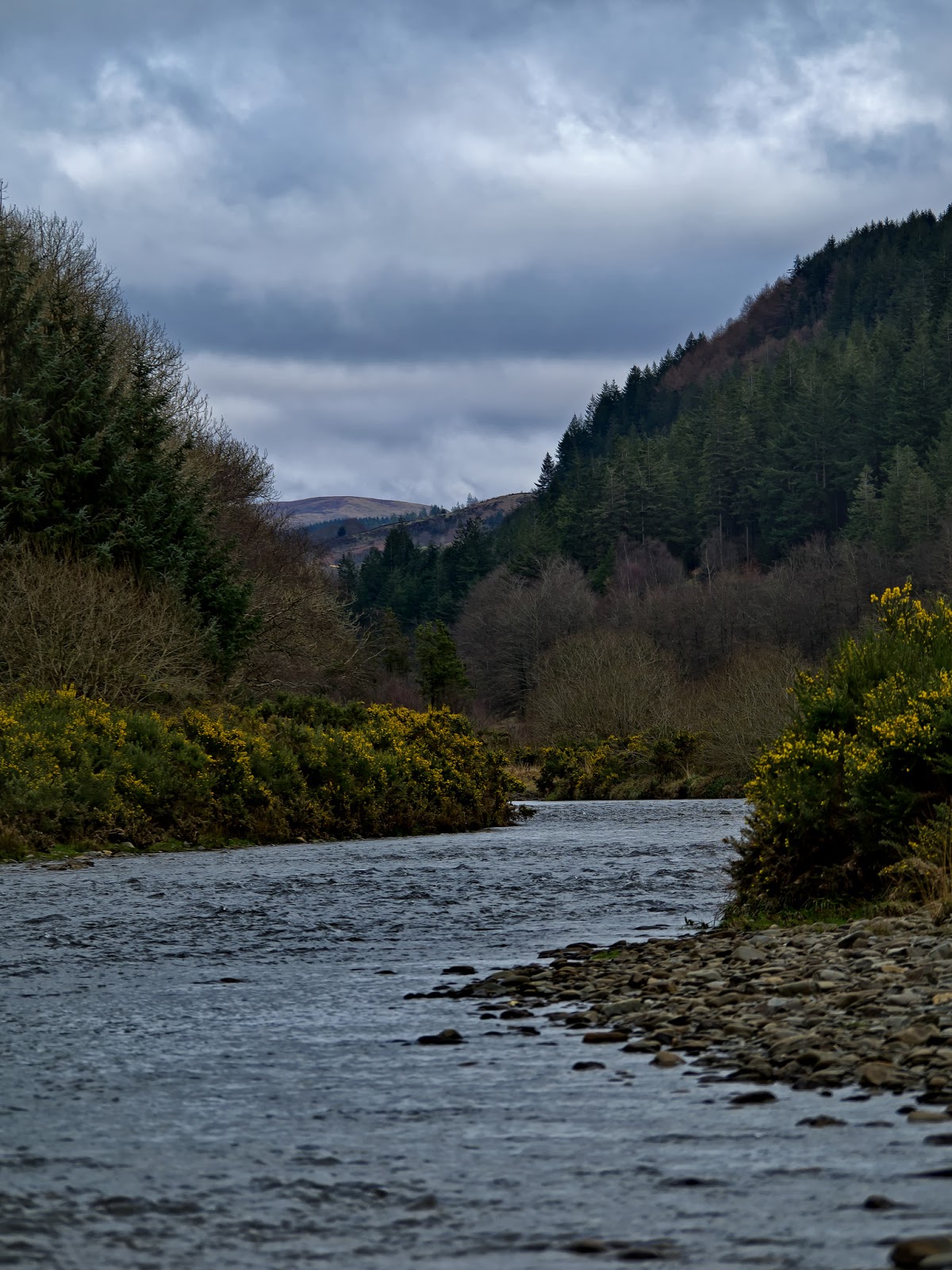
Here I listed my spare kidney on Ebay to fund the parking charges, donned my warm clothes and a head torch and rechecked the map of my route. When I initially started planning for my trip to Snowdon I had hoped to complete it in milder weather and follow the Snowdon Horseshoe route, along two precarious ridge lines up to and back down from the summit. When I learned that there was sure to be snow on the higher ground, and that I would need to start my ascent in the dark because of when I needed to get home, I shelved that plan for a later day. The revised plan was to get as far into the ascent as possible as quick as possible in case there was a sunrise worth photographing. So I settled on the broad and well surfaced Miners track and started on up.

The thick cloud still obscured the moon, and sunrise was still over an hour away so I began in total darkness with no view ahead, but I knew that the mountains towered ahead of me. Soon a few chinks opened in the cloud letting through the first hints of dawn and giving me enough visibility that I could turn off my torch. As my eyes adjusted to the new, lesser darkness I could make out a snow capped outline ahead of me! I assumed this was Snowdon and smiled to myself, my goal was in sight - I was wrong though. What I could see was just a part of the ridge, some 300m below the still cloud bound summit.


The Miners track is straight forward and easy going until the far side of Llyn Llydaw where it gets a little steeper and rougher, but it is above Glaslyn that the path, and the view, starts to get really interesting. This is about 2/3 of the linear distance into the route, but only 1/3 of the vertical ascent, leaving a steep route to negotiate over the last few kilometres. It was also around this point that the laying snow became persistent and the rising sun started to break through a chink in the low hanging clouds. The combination of cool blue lake, majestic snowy mountains, broken cloud and warm sunlight made for a breath taking view!

But the concept of 'a view' was about to become irrelevant. The laying snow and the lowering cloud merged into a wall of white before me. I lost the route of the path in the snow several times and struggled to gauge how much further I had to go. I couldn't see the track 30 meters ahead at times, let alone the summit. The wind driven snow had done a comprehensive job of smoothing out the hill side, blending series of steps into smooth icy slopes. With the aid of poles and studded snow walking aids (proper crampons don't feature on my kit list yet) I made it to the summit ridge feeling in my inexperience as close to a proper alpinist as I've come yet, with just a short walk along the ridge remaining to arrive at the actual summit.


The ridge looked alien! The frigid temperatures and driving winds over the preceding days had sculpted icy feathers over every inch of it. Snow remained only in the most sheltered of spots, the rest blasted off by howling winds. The swirling ice traced the eddies of the wind as clearly as smoke in a wind tunnel and coated the entire landscape, with only the dark rocks beneath breaking the white of the ice. The now brightening cloud still firmly clamped on top of the mountain cast a flat, contrast-less light uniformly over the ice-coated everything and created conditions unlike anything I have seen before - a completely monochrome landscape.

The summit cairn and trig point looked like a chaotically iced wedding cake, and the deserted train station like a movie set from 'The Day After Tomorrow'. I was the first to the top that morning - no one else had been crazy enough to start out for the summit as early as me - and the solitude was palpable, although short lived. A trio of walkers had been gradually catching me for the past hour while I kept stopping to take pictures and they arrived just a few minutes later. I'd like to think that pioneering a path through the fresh, unsullied snow for them had slowed me down, but the reality is almost certainly just that they were faster than me!


I didn't stay long at the top. I had made my pilgrimage, had my adventure. Call me anti-social but sharing these special places with throngs of other people spoils it for me. More often than not it is the solitude itself that I am seeking, and the personal challenge of completing the ascent in the first place, the views are a bonus, but a very welcome one when they are there! Sure enough I passed many other hikers toiling upwards while I descended, but even when the cloud lifted and the iced-gem summit appeared against a bright patch of blue I didn't envy them, because they had to share it, and I had had it to myself, if only for a few minutes.

Now that the clouds had lifted and the sun was properly up the views on my trek back down were every bit as stunning as you would expect of the Snowdonian Mountains in winter. Snow capped peaks were there to be seen in every direction and the low winter sun picked out the finest of topographical details in a landscape which begs the question why we Brits ever feel the need to travel abroad to see beautiful scenery. I made it down about 5 hours after I originally left the car. I shed my cold weather kit, now feeling distinctly over dressed among gaggles of children and young couples who at midday were only just arriving. I left quickly, keen now my adventure was over to get back to my family for the remainder of the day. A few miles away I had to stop and take in the view behind one more time. The clouds had now lifted fully and the snowy summit of Snowdon had revealed herself to all the world. It was the perfect parting memory, one that is certain to bring me back again soon. This may have been my first visit to Snowdon, but it won't be my last!


Richard

Friday, 12 January 2018

A Belated Happy New Year; and sharing some plans!

Happy New Year to anyone reading this. I hope you enjoyed whatever break you were able to have, and are looking forward to the year ahead.

Hoping that 2018 brings many more mornings like this i.e. out of doors enjoying them!
Along with just about everyone else a New Year triggers for me a flurry of goal setting, plan making and commitment (some stronger than others). I mentioned on social media the other day that some of my plans for the year required me to be somewhat fitter than I currently am, and I thought I'd flesh out those plans a bit for anyone who is interested (recognising that that may be no-one at all). This is for two reasons 1) because it is by far and away the most exciting thing I have to write about at the minute and 2) if I write them down now it will add to my motivation later in the year when I am trying to follow through with those plans. As such plans always seem, at some point, to prove inconvenient, difficult or hard, any extra motivation would be welcome.

I'll come to that in a minute. I also mentioned that I wanted to try and post content, particularly images, which are more representative of EVERYTHING I get up (which is relevant to the 'wild guy' narrative anyway). Don't get me wrong, all the images I post are mine, but I am often guilty of only posting the ones which I think are good in their own right and as such the story that they tell is often a little disjointed. I'd like that story to become a bit more complete, and that may involve posting some images which seem of a lower standard but tell the story better. It still isn't going to be my personal life, photo's of the office and such like, but it may be ones which on the face of it seem ... worse, but I'll try and explain the story they tell as I go.

My plans for the year then. Basically my plans centre on the desire to make 2018 the year, hopefully the first of many, where I stop saying 'that would be cool / great / brilliant' and start saying 'that WAS amazing / incredible / unforgettable!' and so on. In other words I want it to be the year I start doing rather than dreaming. Many of the plans for the year are the culmination of years, in a few cases decades, of dreaming of adventures. I won't set out detailed plans now because I'll be writing about them all individually both at the planning stages and at the fun bit (although I find the planning fun too if I'm honest).

Therefore in an approximate chronological order (which is subject to change!), in 2018 I will:
- Climb Snowdon
The Ystwyth in Mid-Wales. All being well at some
point this year this view will include me, mid-river!
- Visit the Outer Hebrides; specifically fly into the only commercial airport in the world where the runway is on a beach - Barra - the southern most island in the Outer Hebrides island chain. (Flying this route was my dream job when I was a teenager. This trip is a birthday present for a 'milestone' birthday this year - thank you to my beautiful wife and my parents-in-law for making this possible)
- Visit the Isle of Skye for a family holiday
- Hopefully climb Ben Nevis again on the way to Skye.
- Walk / Swim / Raft from 'source to sea' down the River Ystwyth in Mid-Wales.
- Do the UK Three Peaks with my brothers

That will do to be going along with, there are a few others which have bigger question marks hanging over them at the minute, mostly just down to available spare time, so I won't add them yet but hopefully there may be a few extras to add to this list before years end.

The fitness concern is largely centered on the Three Peaks attempt. I don't just want to complete it, I want to complete it well and if not easily then at least without serious discomfort. It's for this reason that I will be trying to make the most of working in the Peak District and actually going out for a walk, usually up a steep hill, before work or during lunch breaks and so forth. To provide one more level of motivation I signed up to a few 'challenges issued by UK outdoor magazines;
- the #walk1000miles 2018 challenge (Country Walking Magazine), and
- the #everestanywhere challenge (Trail Magazine).

Both should be eminently do-able provided I pull my finger out and actually start making better use of my time... what this essentially amounts to is me learning not to sleep as much! I'll leave this there for now - if all this comes off there will be some stories to tell, pictures to share and hopefully maybe even a little inspiration to give. Not that I expect anyone to be inspired by my efforts, but rather I hope that you may be inspired by the places I visit and the enjoyment I hope to derive from the journeys to get there!


Richard


Monday, 16 October 2017

Let's stop here, Daddy

** We try to  set aside one day a month for us as parents to spend one-on-one time with 
our children - having only two children at present the numbers work out neatly! **

The plans had been made, the kit gathered, snacks selected, 'Rhino the adventure wagon' locked and loaded and we were half way to Kinder Scout in the Peak District National Park. A familiar route for me, as it is also my daily commute. This was to be Megan's first 'big hill' experience because she has been asking recently to climb a big mountain, and specifically 'the 4000 foot mountain' (Ben Nevis). I had informed her she would need to do some training for that, and thus the plan had been born to climb the highest hill in the Peak District.

However, as we were passing Ramshaw Rocks, just east of the Roaches and barely visible off the A53 in the swirling mist Megan piped up - She recognised this place. This was where we had been with Uncle Rob and Aunty Serena. She liked it here. Could we stop here instead please?

So we did - it saved us almost 40 miles of driving off our round trip after all. We continued round to Roach End at the far west of the ridge. Having always walked it from the east before that day I thought even a slight change of scenery would be welcome, not that you'd ever get bored of the Roaches I suspect!

The weather was ... sub-optimal. The cloud was down, the wind up and the rain persistent enough that we were getting wet from the get-go, but Megan lapped it up. She loved clambering over the various rocky tors and outcrops, peering down over the edges to see what was below.
(Luckily, on this occasion, she was also very good at following instructions, because some were high enough to be extremely unforgiving of slips and trips near the edge!)

She wasted no time negotiating when the sweets were going to make an appearance, and spent a large chunk of our time out that day clutching a slowly dwindling bag of midget gems - I managed to persuade her that the chocolate would suffer as a result of similar treatment so that stayed in the bag!


To anyone who has been to the Roaches no explanation is necessary of how impressive they are; to those who haven't, my inadequate vocabulary isn't going to do it justice, so I've thrown a few pictures in.

It is a spectacular grit stone ridge, with frequent rock outcrops along what is in reality more cliff edge than ridge for most of it's length. I thoroughly recommend a visit at some point, whether as a keen walker, casual observer or more daring rock climber it holds something worth experiencing for everyone.

Peregrine Falcons have nested there regularly in recent years, and Staffordshire Wildlife Trust, who manage the site, set up a Peregrine Watch station near Hen's Cloud (at the eastern end of the ridge) to give visitors views of these awesome birds of prey.

Megan loves it there - the combination of rocks and slopes, stunted trees and huge views to the south over the Staffordshire moorlands are stunning - when the cloud base allows - and we will certainly keep coming back. Another definite area to take a look at is Lud's Church to the west. But we've been there recently for a family trip so I'll save that for another time.

Eventually the cloud lifted giving us those aforementioned views South, down towards Tittesworth Reservoir and beyond. With the lifting cloud the wind eased and the rain stopped which made out return trip along the ridge back to Rhino more enjoyable.

Most importantly, Megan had a great time and we got to spend some time together out and about - she also started her Ben Nevis training, although I think we have a little way to go just yet. We are planning to go up to the Isle of Skye next year, which would be a prime opportunity to stop of at Fort William on the way past, but... we will have to see.

Richard


Saturday, 1 July 2017

The Dale of the Dove - or, For the Love of Maps.

Just like any loving parent, I want the best for my children. I want my children to learn to love maps. 

I love maps, I always have. There is nothing quite like unfolding a map, laying it out on the floor and then stretching out alongside it to take it all in. Automatically I begin to trace the rivers, follow the ridges, pin point the high spots and link them all together into hypothetical routes, continually re-drawn to include particularly appealing features not originally noticed. It's wonderful - lean too close and you might just fall in!

Dove Dale is a perfect example of a landscape which immediately catches the eye of any diligent student of cartography - the sinuous river, the formidably steep valley sides, the ribbon of woodland clinging on for dear life in an otherwise open, pastoral landscape. Potentially last, though certainly not least you notice the names! While the title 'Dove Dale' itself paints a relatively harmless picture, throw in 'Ravens Tor', 'Hurt's Wood', 'Reynard's Cave', 'Tissington Spires', 'Jacobs Ladder', 'Twelve Apostles', 'Lovers Leap' and 'Thorpe Cloud' and you have beginning, middle and end to a cartographical fantasy trilogy without ever leaving the living room floor. And that's before you consider the list of caves, weirs and natural arches long enough to keep Enid Blyton's Famous Five busy for their entire summer holidays.

I didn't need to keep my children occupied for an entire holiday - we were aiming for just a single morning. The scramble up to the caves, and indeed the majority of the path along the valley itself was out of the scope of the littlest legs of the family (just 1 year old) but these trips are about planting the seeds of adventure and exploring. So fully expecting to never make it past the stepping stones (perhaps less than 1km from our start point!) we left the almost entirely deserted car park in scruffy clothes to enjoy a couple of hours of family fun in stunning, natural-world beauty, without the crowds. It was a dull grey day, and only just turned 9am but it wasn't just the weather, or the (relatively) early hour which allowed us to beat the crowds. My daughters school was closed for the day so we were there on a week day in term time - a rare and perfect opportunity to see Dove Dale as God intended and it's name implies ... peaceful!

And so it proved to be - we only had each other for company on the path out along the river - that is unless you count the ducks, grey wagtails and almost unbelievably confident crows which stole the meagre portions of bread the little ones had brought along for the ducks. We, that is my wife and I, have been to Dove Dale before, and we've wanted to bring the children for a while because we loved it. But knowing just how busy it gets, we wanted to save it for a day when we could make it special and we could all enjoy it as much as possible, preferably with as few other people as possible. And obviously to enjoy any river valley fully, you need to get wet. Why wouldn't you? Hence the scruffy clothes.

Pretty much since the first day our youngest started walking we gave up hope of keeping him out of the water on family outings and instead embraced (and sometimes even encouraged) his fearless love for going the extra watery mile, even if it means the return miles are soggy. He was true to form making straight for the river and the puddles, splashing in the surprisingly bracing currents (given that it was early June) and loving every minute of it. The smile never left his face... until our little girl (3 1/2 years his senior) started scaling the scree slopes up the valley sides. This was beyond his still slightly wobbly ability and at that point he lost the smile and started to get cross, thinking that he was missing the fun! This is not a child who will need any encouragement to explore when he gets a bit steadier on his feet.

We arrived at the stepping stones without major incident and spent a few happy minutes hopping from stone to stone and trying to make sure our he didn't get out of his depth while following the ducks into the river. I even got to take a few pictures while the rest of the family were tucking into our modest picnic rations! The rain had started by this point, but we were already wet, and it wasn't too cold so we weren't going to let that stop us. But then the school groups started arriving and the relative peace we had enjoyed was at risk of being disturbed. So we called it a day and headed for home, wet, dirty and happy - exactly as it should be. 

A few days ago we had the map back out - the seeds are growing!

Richard